Learn to use Outdoor Access Commission maps to support crag access
Rock climbing access issues are coming into sharper focus, and the Outdoor Access Commission's public access maps can help climbers connect with the right people.
Rock climbing access issues are coming into sharper focus, and the Outdoor Access Commission's public access maps can help climbers connect with the right people.
This article is written in collaboration with Herenga ā Nuku Aotearoa, the Outdoor Access Commission (OAC). Read on.
Climbing a cliff requires tenacity, and even getting access to the base of the crag can be tough.
Historically, the climbing community has faced the challenge of accurately identifying the relevant land types, administrative bodies, and key stakeholders (including mana whenua partners) for the areas they climb.
Developing relationships with the right people is key, and the Outdoor Access Commission is here to help. For example, their new Tangata Whenua Map can help climbers know whom to approach to negotiate access to a particular crag.
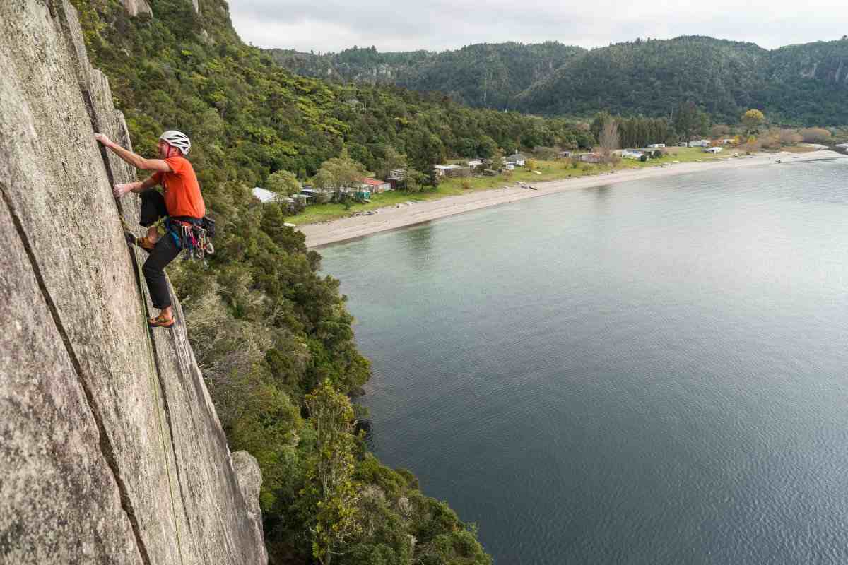
Climbers and hapū Ngati Te Maunga have built a positive relationship at Whanganui Bay (pictured). Photo: Tom Hoyle.
The map displays different types of Māori land, which can be overlaid on the map of public access areas. This map shows places where the public has a legal right to access land, such as unformed legal roads (“paper roads”), marginal and esplanade strips alongside water, conservation land, parks and reserves. It also shows a variety of property information, hunting and fishing spots, and outdoor recreation information, such as walking trails, horse riding, cycle routes, and mountain bike tracks.
A climber could use the OAC Topographic Relief base map to pinpoint a cliff location, then overlay the Tangata Whenua Map, followed by the public access areas map. This would confirm which land parcel the crag sits within and identify possible access routes to it.
You can view all layers against a variety of detailed basemaps such as the LINZ Topographic basemap, aerial/satellite imagery and multiple simplified vector basemaps.
OAC provides these maps free for anyone to use. One of their statutory functions under the Walking Access Act 2008 is "compiling, holding, and publishing maps and information about land over which members of the public have walking access".
This data includes NZ Road Parcels, DOC Public Conservation Land, Reserves, Esplanade Reserves and Public Access Easements.
However, it's important to note that not all legal access is physically or practically accessible or always open. For example, many unformed legal roads are physically impractical and some public access easements can be temporarily closed for health and safety or farming reasons.
How to access your chosen crag or cliff
-
Find your climbing area and check what public access exists:
a. Open OAC’s Pocket Maps (on your phone) or WAMS mapping system (on a desktop).
b. If you are on the desktop version, you can use their Tangata Whenua Map to check who has a mana whenua or territorial connection with the area in question. Note: this may be distinct from legal ownership, but it is no less important for negotiating access. From the map gallery, choose the Tangata Whenua Map.
c. Choose a basemap from the tab at the top of the screen. As mentioned, for climbers a relief map will probably be most useful. In the desktop version, choose the Topographic Relief basemap. In Pocket Maps, choose the Light with Relief basemap.
d. In the layers tab of either WAMS or Pocket Maps, also at the top of the screen, add the Public Access Areas map layer and as many of the following as you find useful: Recreation, Hunting and Fishing, Tracks and Trails, Property and Water.
- If it’s unclear to you whether public access exists, contact ACAT to check, and to ask for support in obtaining it if not.
- If you will need to cross private land, use the map layers to identify relevant landholders, including iwi, councils or other territorial authorities. This can be a good idea even when the maps show legal access. Some landowners may not be aware that, for example, an unformed legal road bisects their property. Also, they may have important information such as dates of closures for lambing or forestry operations, or there may be health and safety considerations you need to be aware of.
Advice for speaking to landholders
Gaining permission to access Māori land - If it’s not going smoothly, or you’d just like some advice or guidance, contact your local Herenga ā Nuku Regional Field Advisor.
More information: About OAC Maps